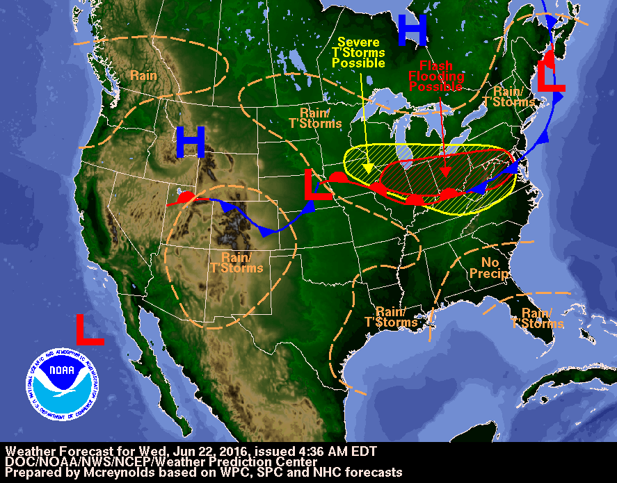
Thunderstorms will develop late this afternoon and evening in advance of an approaching
low pressure system. The greatest risk for severe weather will likely be north of the I-74
corridor between 5pm and 10pm. Damaging wind gust in excess of 70 mph...golf ball-sized hail
and isolated tornadoes will be possible. Depend on Cities 92.9 for updates.
No comments:
Post a Comment